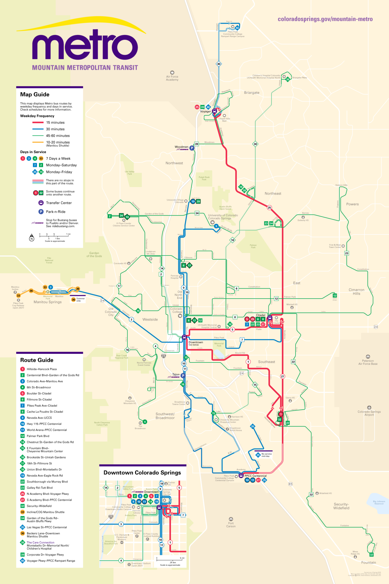
I don’t have anything in particular to say about the transit system in Colorado Springs, Colorado. I chose to map it as a design exercise — see below — and I chose Colorado Springs because it’s a typical mid-sized American city and because I’m familiar with it, as I have family there. (Note that this map does not include changes made since this map was produced in Spring 2020; here is the current official map.)
NOTES ON DESIGN
This is my first attempt at a complete transit system map in the style of those produced by CHK America and CHK staff and ex-staff including Oran Viriyincy and Kirril Negoda (some examples: Los Angeles; Austin; Oklahoma City; Honolulu; Richmond, Virginia; and Spokane, Washington). Like those maps, mine is a hybrid of a geographically accurate map and a simplified diagram. It also categorizes routes by frequency and days in service, so the most useful routes are highlighted. The idea is to increase awareness of where one can go by transit without providing so much detail that it might confuse those unfamiliar with the system; the street network should be recognizable, but the map should be visually streamlined, including only essential information, and avoiding unnecessary complexity. In my view, this should be the standard approach for any transit system using city streets; these days, detailed trip planning can be left to online mapping services and the agency website. The typeface here is Univers, the same used in the agency logo.
> View high-resolution PDF