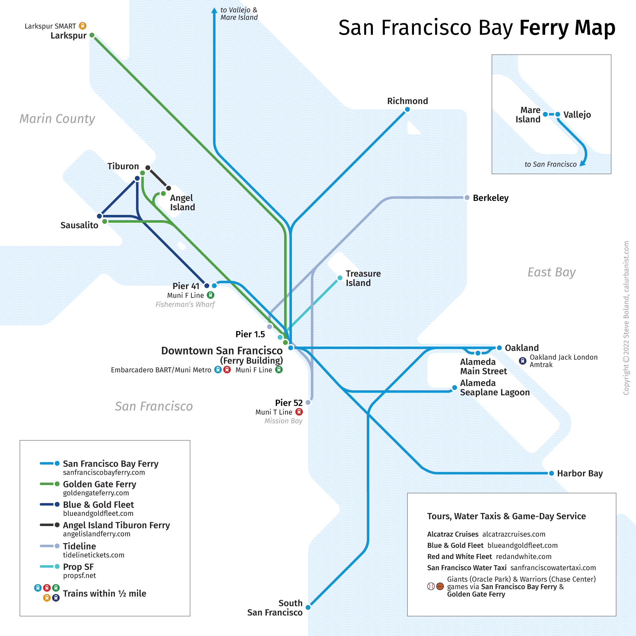
For nearly a century after the Gold Rush, the only way across San Francisco Bay was by boat. East Bay trains (including trains on the Transcontinental Railroad) unloaded passengers onto San Francisco ferries at the ends of earthen piers, or “moles,” extending as far as two miles into the Bay. Later there were giant auto ferries similar to those on Puget Sound today, and San Francisco’s grand Ferry Building at the foot of Market Street was the second-busiest transit hub on Earth, after London’s Charing Cross Station. Then the bridges came — the Bay Bridge in 1936, and the Golden Gate the following year — and business dried up. Only recently — starting with the Loma Prieta Earthquake in 1989, when the Bay Bridge was unavailable for a month, but accelerating in the 21st Century — have commuter ferries staged a comeback, as the newly formed San Francisco Bay Ferry has taken over existing East Bay routes and started up new ones, with more planned.
Notes on Design
Historically, most ferry maps have looked like airline maps, with realistic geography and arcing lines. Maybe it was something about soaring across open skies, or sailing across open water. Lately, though, more have taken a diagrammatic approach, like urban rail maps — see New York, Sydney and Oslo, as well as MTC-designed maps at the Ferry Building and SF Bay Ferry’s future map. The typeface here is Erik Spiekermann‘s Fira Sans.
> View high-resolution PDF
