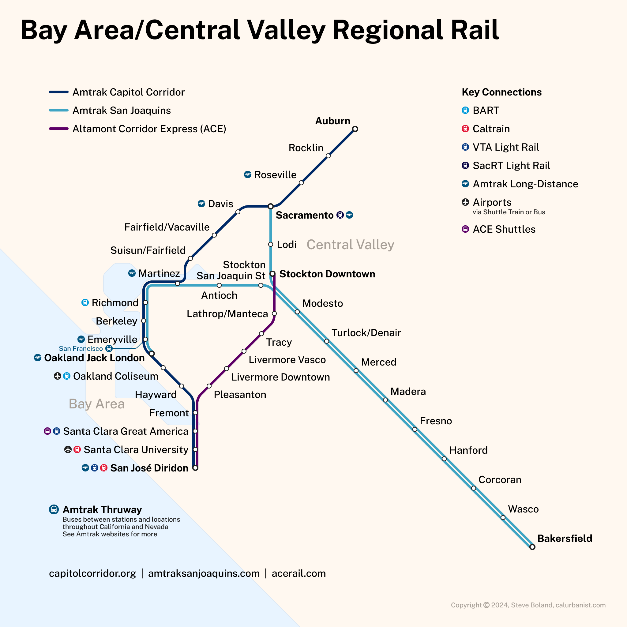
Like the Bay Area, greater Northern California has too damned many transit operators. There are currently four (long-distance) commuter and intercity rail lines in the region (or three if Gold Runner, formerly the San Joaquins, is considered a single line with branches) that are run by three different agencies*, with two more on the way. Arguably, it doesn’t really matter — with infrequent schedules and no timed transfers, or discounts on transfers, these are functionally standalone lines serving separate markets, not an integrated network. But California has a state rail plan calling for greater integration, and in the Bay Area, integration of mapping and wayfinding is already underway. A map of megaregional transit options would be an easy way to raise awareness, simplify entry for new users and reduce barriers to access. (* Technically, the San Joaquin Regional Rail Commission both runs ACE and oversees the San Joaquin Joint Powers Authority, which runs Gold Runner. All the more reason to combine branding.) Note that this map shows the under-construction Oakley Station, which, sadly, will replace the existing Antioch-Pittsburg Station in the near future.
Notes on Design
This map replaces a previous map that included planned expansions of Northern California rail. Short version: Those expansions were both continuing to expand and looking more and more delayed, or unlikely. Some Amtrak maps also show Amtrak Connection (formerly Amtrak Thruway) bus routes, although more important connections, such as BART, are rarely shown. My favorite of the existing agency maps has to be ACE‘s, if for no other reason than the wacky pictograms. The typeface is Public Sans.
> View high-resolution PDF