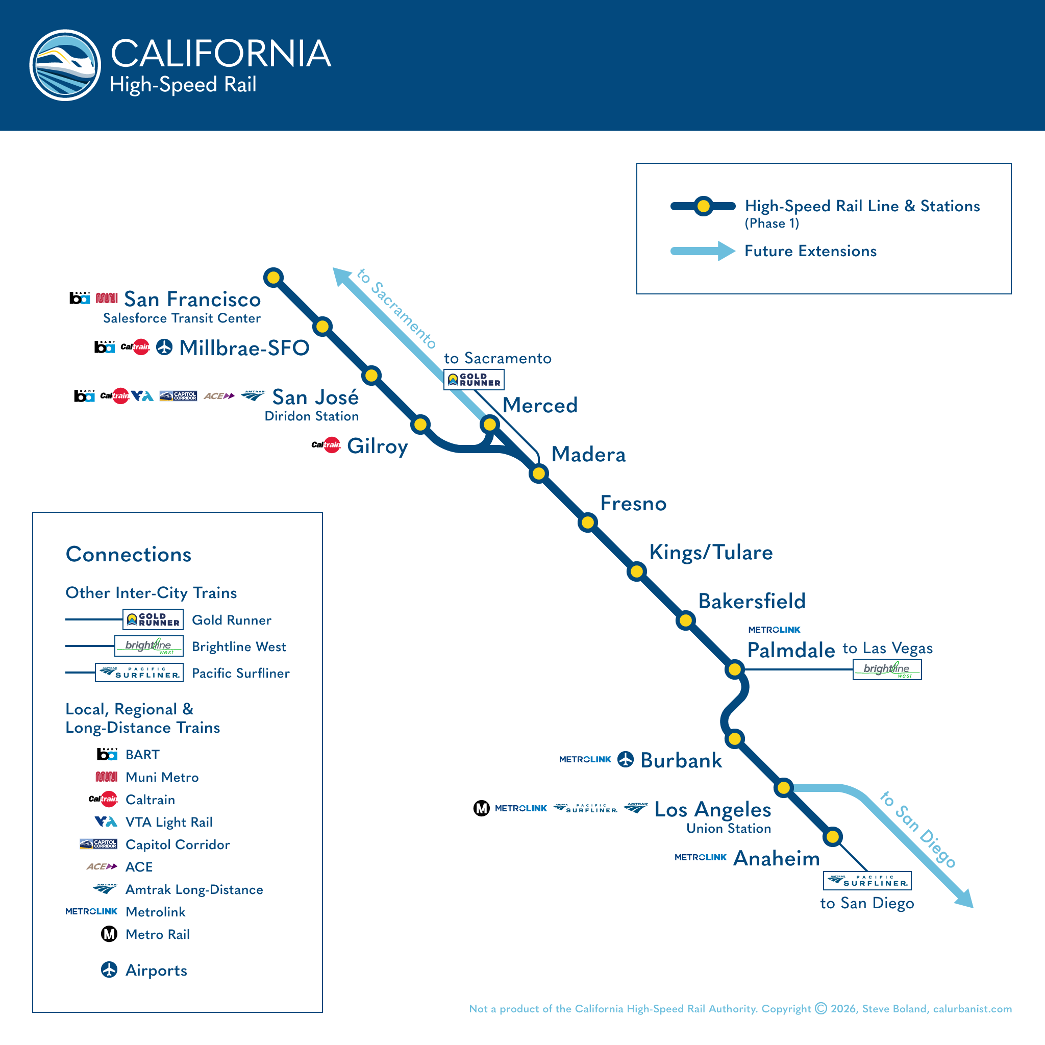
It’s still way too soon to say when some version of this map might finally become reality. But California High-Speed Rail has been making progress lately, and not just on construction. The Trump administration, of course, tried to defund it, but the State responded with a reliable (if still not quite adequate) funding stream. And leadership has grown more pragmatic, brainstorming creative ways to generate revenues, value engineering overbuilt infrastructure and planning to get from Palmdale to L.A. the same way trains will get to San Francisco from Gilroy, by continuing onto electrified existing tracks. This map is based on that plan. Unsurprisingly, the map has to make a number of assumptions: Will Merced Station be moved to a greenfield site, requiring connections to conventional trains to be made in Madera? Will Brightline West be built? What about the link between CAHSR and Brightline West? And who would operate that?
Notes on Design
I’ve been making CAHSR maps since 2008, the year Californians voted for both high-speed rail and Obama. That map was last updated in 2018. This map, obviously, is an evolution of that one. I will say, one thing the Authority has unequivocally gotten right is its California blue-and-gold color scheme. If its livery doesn’t look something like this, it will be a missed opportunity. Since a recent rebrand (its first in a generation), the Authority’s official font has been Quasimoda, which is what’s used here.
> View high-resolution PDF