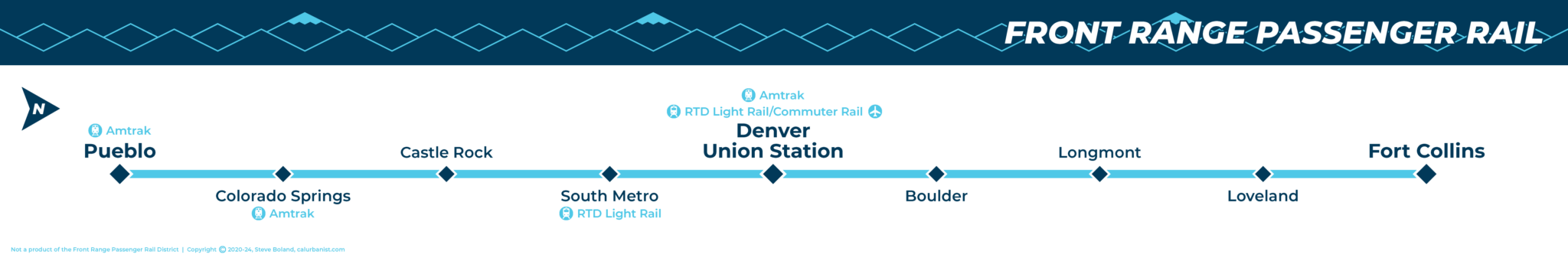
The idea of an inter-city/commuter rail line serving the fast-growing cities lined up along Colorado’s Front Range has been around for years, but lately it’s finally gotten traction. It’s about time: There are now close to 5 million people at the foot of the Rockies in a relatively narrow corridor less than 180 miles long. Technologies from high-speed rail to Hyperloop have been considered, although conventional diesel rail (like that in neighboring Utah and New Mexico) is now moving forward, if in stages. This plan would also finally allow passenger rail between Denver, Boulder and Longmont, the last great missing piece of Denver’s FasTracks plan. (The State also appears to be serious about a new line on existing tracks in the northern mountains, and there’s a proposal to connect the Front Range corridor’s south end to the Amtrak Southwest Chief.)
Notes on Design
This strip map is based on the Front Range Passenger Rail brand, and includes symbols with a connection to Colorado and the Front Range, namely diamonds and mountains on the western horizon (including the three most prominent peaks visible from the Front Range, Pikes Peak, Mount Blue Sky, and Longs Peak). It’ll be updated with the line’s new name — Colorado Connector, or CoCo (which, sorry, is both bland and too cute) — whenever that brand is made available. The typeface is Montserrat.
> View high-resolution PDF