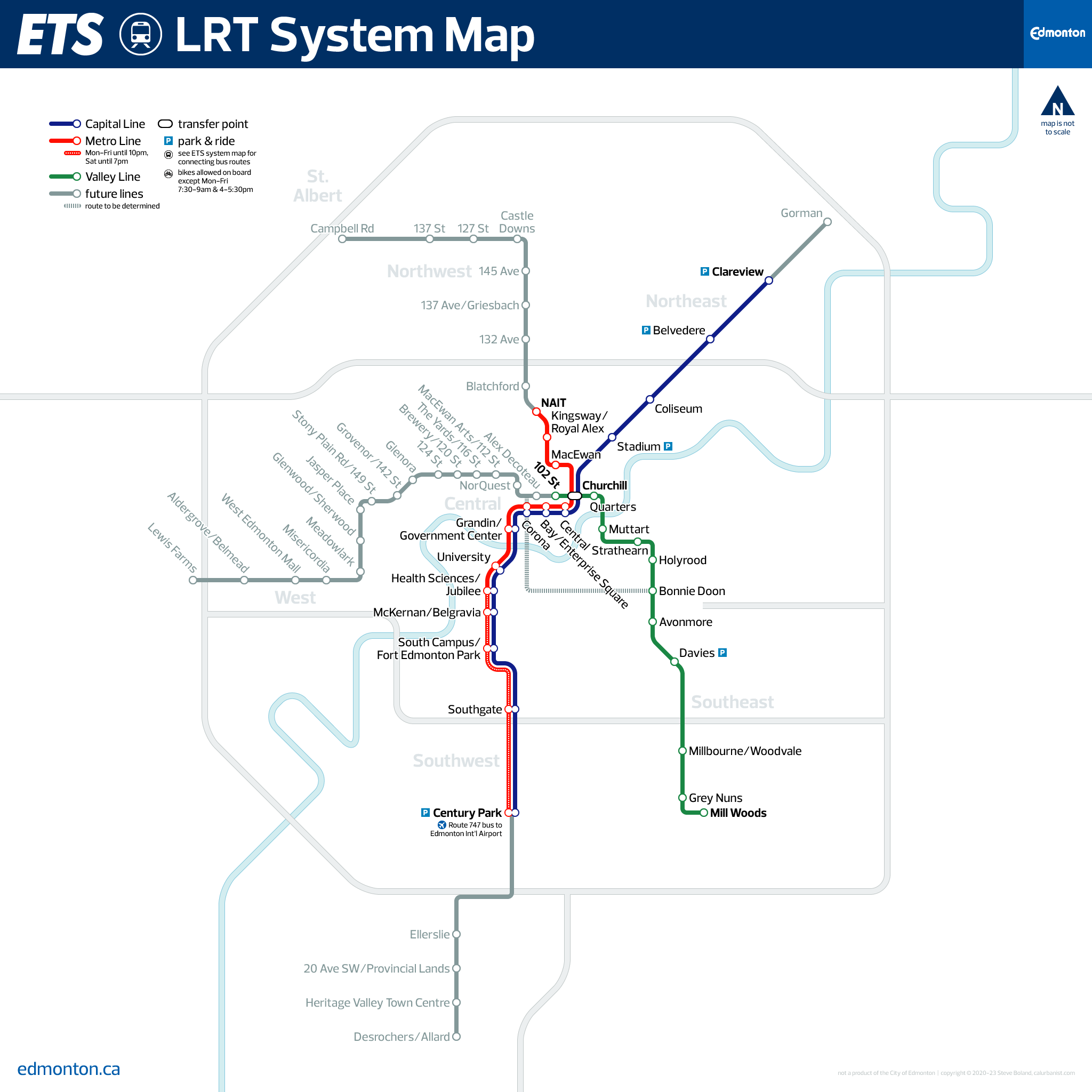
Edmonton, Alberta, Canada is a metropolitan area of around a million-and-a-half people, about the same size as Oklahoma City. Yet in the late-’70s it built the first modern light rail line in North America. Like most of those who followed, it re-used an old railroad right-of-way, but it also tunneled downtown, like a German stadtbahn. The system now has more than 110,000 daily riders, more than Dallas or Denver. But Edmonton is just getting started: Until recently just 15 miles with 18 stations, the system will be nearly tripled in size by recently completed, under construction and planned expansions. And it’s going in new directions: While the original system was largely built to rapid transit standards, with off-street rights-of-way and high-platform stations, some more than a mile apart, new lines will feature low-floor trams with street-level stops.
Notes on Design
While Edmonton transit overachieves, and while the City’s branding is modern and attractive, transit operator ETS’s graphic standards are a bit basic. This strip map is the agency’s only LRT map. This map uses the City’s typeface, Prelo.
> View high-resolution PDF