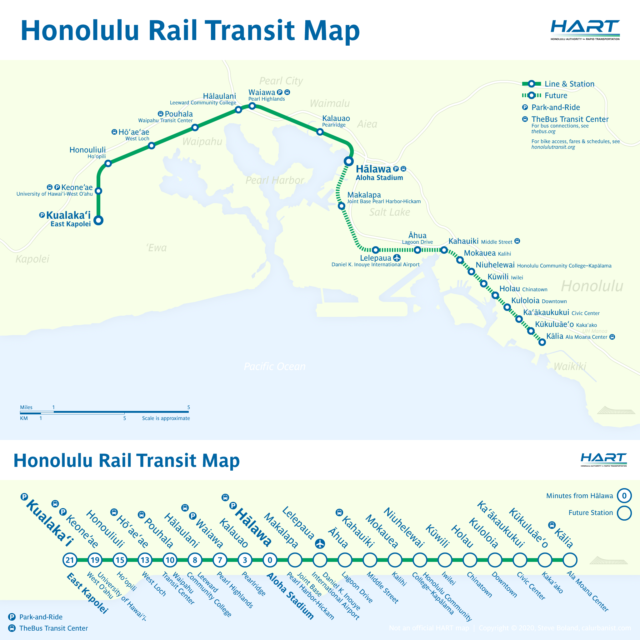
Where to start with the project formerly known as Honolulu Rail Transit, now branded as Skyline? After years of delays and cost overruns, the first leg, from the western suburbs to Aloha Stadium, is finally open. That’s the good news. The bad news is, it’s not scheduled to reach the airport until 2025, and Downtown Honolulu until 2031 (you’ll also forgive me if I’m a bit skeptical about timelines at this point). Worse, the last two stations east of Civic Center — including the busy Ala Moana Center bus hub — have been delayed indefinitely. And that’s to say nothing of the original proposal, which included branches to Waikiki and the University of Hawai’i. It’s too bad: The south shore of O’ahu is a narrow corridor with hundreds of highrises and high existing bus ridership, and the concept, based on the automated light metro technology used in Vancouver and Montréal and planned for Toronto, is a good fit.
Notes on Design
As with my map for another troubled project, California High-Speed Rail, I’ve given up on updating this map. The recently updated official map also appears to borrow elements from my map, which dates to 2014. The typeface is Parisine, which is used on station signs.
> View high-resolution PDF
