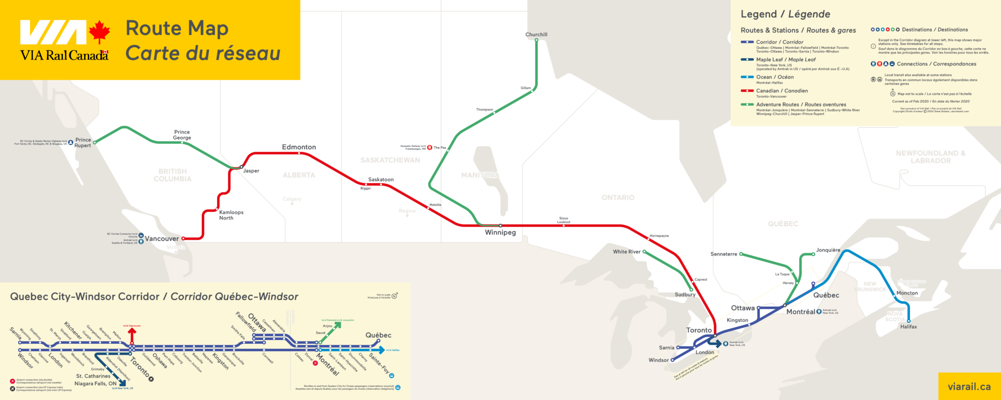
VIA Rail is the Amtrak of Canada (or, I guess you could say, Amtrak is America’s VIA Rail). Most service is in a single urbanized corridor — the Quebec City-Windsor corridor, aka “The Corridor,” instead of the Northeast Corridor — while much of the rest consists of long-distance routes, some famous for their scenery, such as the Canadian between Toronto and Vancouver. VIA Rail is a bit different in that it still operates a few lifeline routes to isolated areas, including service to roadless outposts like Churchill, Manitoba, on Hudson Bay. Trains will also pick up and drop off passengers between stations in remote areas with advance notice. Sadly, VIA Rail is like Amtrak in that its route network has been greatly reduced over the years.
Notes on Design
Any amateur mapmaker will tell you that one of the joys of cartography as a hobby is that you can virtually explore faraway places — through research, then again through the act of drawing. I may never visit Churchill — a place where polar bears wander the streets — or even Halifax, Nova Scotia, a city of 400,000 that still feels impossibly far away. But one can dream. As for this design: Like most of my maps of late, it combines elements of geographically accurate maps and schematic diagrams, and it uses VIA Rail colors and Maax, the non-custom version of VIA’s house typeface, ViaMaax.
> View high-resolution PDF
