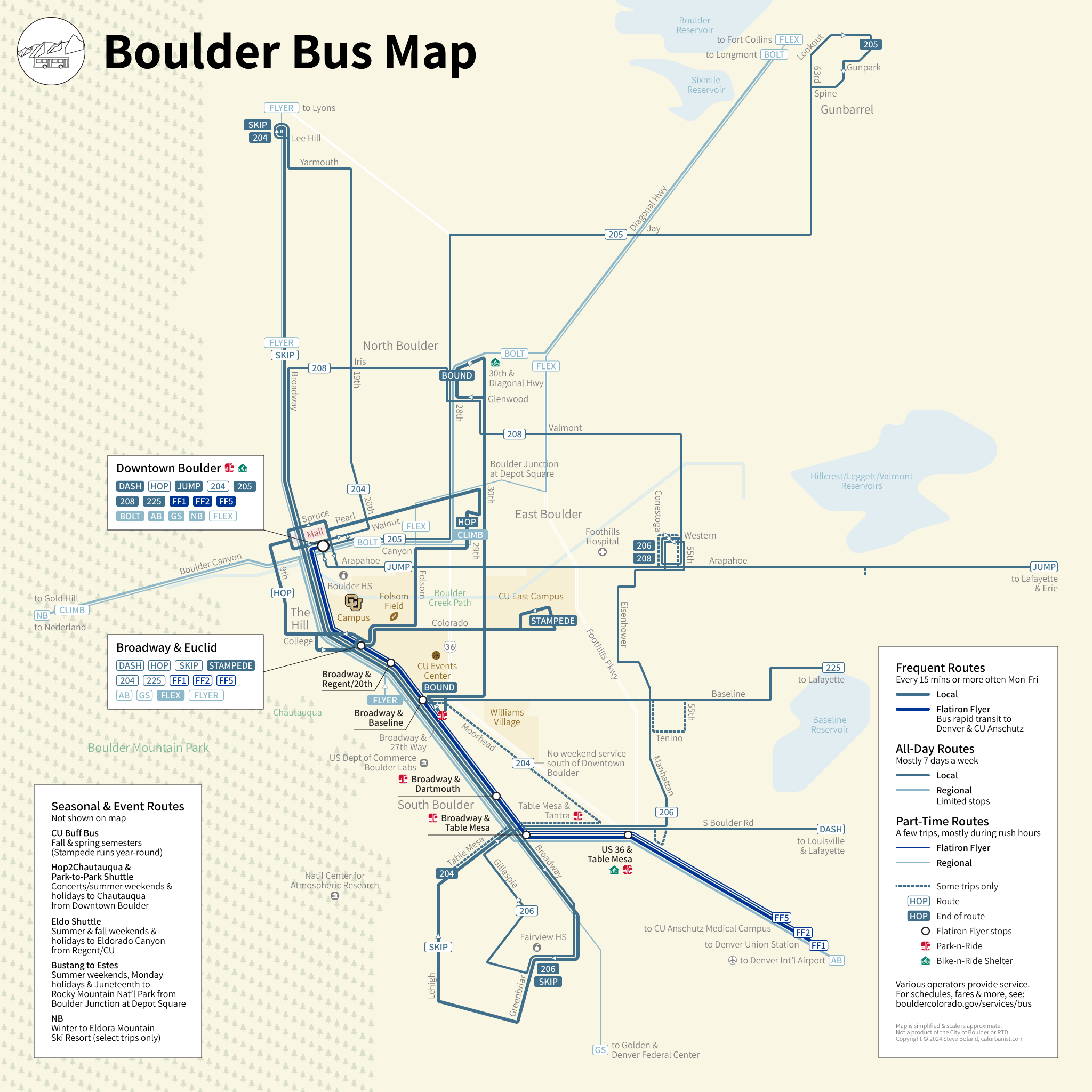
Like other college towns, Boulder (pop. 108,000) has an outsized bus system. Unlike other college towns, its system is highly complicated, including service by the regional operator, Metro Denver‘s RTD, specially branded routes subsidized by the City itself, campus shuttles, and individual routes funded or run by the State, the County, another transit agency and a nearby town. So is there a map to help make sense of all this? Not really! Like RTD, the City relies on a digital map. The County used to produce a print map, but it was last updated in 2018, before COVID-era service changes. Digital maps are great — users can zoom in for more detail, or click for more information — but their reliance on geography means that complex systems can’t be streamlined and simplified. Nor, obviously, can online maps be posted in shelters. For transit systems, at least, digital maps should complement static maps, not replace them. Anyway, you could say that I got my start as a transit planner when, as media director for the University of Colorado student government, I helped promote the first City- (and university-) funded bus route, the HOP. Go CU!
Notes on Design
I’m not a big fan of strictly diagrammatic bus maps; it’s helpful to show some relationship between bus routes and the streets they run on. But that doesn’t mean complex systems can’t be untangled. CHK America and designers including Oran Viriyincy and Kirill Negoda have made an art form of this — as has Fern K. Hahn, who designed this map of the RTD network, including Boulder. The typeface here is Assistant, the City’s official free font; the color palette is also based on the City brand.
> View high-resolution PDF